 - 2019-01-03")
 - 2019-01-03")
 - 2019-01-04")
 - 2019-01-04")
 - 2019-01-04")
 - 2019-01-04")
 - 2019-01-04")
 - 2019-01-04")
 - 2019-01-04")
 - 2019-01-04")
 - 2019-01-04")
 - 2019-01-04")
 - 2019-01-04")
 - 2019-01-04")
 - 2019-01-06")
 - 2019-01-06")
 - 2019-01-06")
 - 2019-01-06")
 - 2019-01-06")
 - 2019-01-06")
 - 2019-01-06")
 - 2019-01-06")
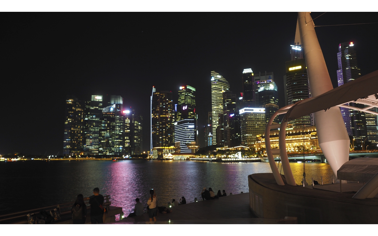
Marina Bay
Marina Bay is a bay located in the Central Area of Singapore, surrounded by the perimeter of four other planning areas, the Downtown Core, Marina East, Marina South and Straits View. The area surrounding the bay itself, also called Marina Bay, is a 360 hectare extension to the adjacent Central Business District. It is also considered the 'newer' downtown of Singapore, as it is mostly built on reclaimed land from the Singapore River during the late 1960s and early 1970s.
Buildings include Gardens by the Bay, the Marina Bay Sands, Marina Bay Financial Centre, The Sail at Marina Bay, Marina One and Suntec City. It is also where the grandstand and pit building of the Marina Bay Street Circuit is located, where it is most commonly used for the Singapore Grand Prix.
In 1969, land reclamation work to create 360 hectares of prime waterfront site began at Marina Bay. The reclaimed land forms what is today the Marina Centre and Marina South areas, and the reclamation work was completed in 1992. In the reclamation process, Inner/Outer Basins (anchorage area for commercial and naval vessels), Telok Ayer Basin (now site of Asia Square Tower 1 and 2) and Inner Roads was removed from the map by reclaiming land, while the Singapore River's mouth now flows into the bay instead of directly into the sea.
The long term visions for the Marina Bay area was first articulated in the 1983 Master Plan by the URA, with the waterfront areas being deliberately kept open to the public. In 1988, the draft plan for Marina Bay was presented to the public in a two-week exhibition where it set out the objectives for the development, among which are optimising the waterfront location and creating a distinctive image with international landmarks that could become a focal point for the city.
![]()
![]()